
Piotr Krzywiec złożyl niedawno do druku artykuł zatytułowany "Birth and Development of Oil and Gas Industry in the Northern Carpathians (until 1939)", który będzie jednym z rozdziałów w przygotowywanym przez Geological Society of London tomie GSL Special Publication zatytułowanym "History of the European Oil and Gas Industry". Poniżej zamieszczamy abstrakt tej publikacji:
Northern segments of the Carpathians stretching between Limanowa (Poland) and Kosów (Ukraine) belonged in late XIX and in early XX centuries to the most prolific hydrocarbon provinces in the world. The earliest written accounts of natural occurrences of hydrocarbon in the Carpathians date back to the XVI century. In XVII and early XIX centuries Rzączyński, Kluk, Hacquest and Staszic provided accounts on methods of practical use of oil. Staszic's geological map shows numerous oil seeps and different rock types containing hydrocarbons. The development of oil industry was triggered by Łukasiewicz's discovery of oil distillation process and construction of kerosene lamp. Following this, oil industry flourished in the Northern Carpathians. Oil production peaked up to 2 million tons of crude oil in 1910. In the subsequent years, level of oil production was steadily decreasing due to turbulent economy. Exploration for oil, gas and ozokerite resulted in development modern micropaleontology and geological mapping, with prime example of regional coverage of almost entire northern Carpathians provided by Geological Atlas of Galicia consisting of 99 high quality geological maps in scale 1:75 000. Geophysical surveying techniques were applied for subsurface mapping, and higher education institutions were established in order to support exploration efforts.
W artykule znajdzie się 20 figur pokazujących publikacje, mapy, przekroje geologiczne itd. związane z rozwojem przemysłu naftowego i geologii naftowej w północnych Karpatach. Wiele z tych ilustracji będzie wydrukowana w kolorze, dzięki czemu stare geologiczne mapy i przekroje zostaną zaprezentowane w swojej pełnej krasie. Publikacja kolorowych figur była możliwa dzięki finansowemu wsparciu PGNiG S.A. oraz ORLEN Upstream Sp. z o.o., za co niniejszym składamy serdeczne podziękowania.
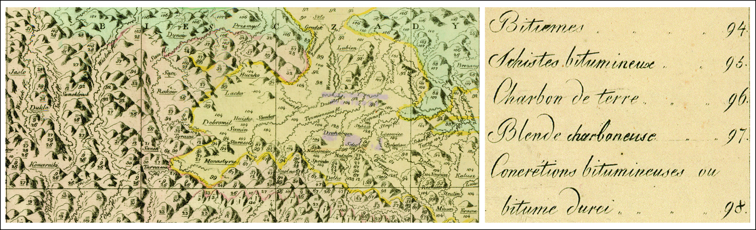
Figura: fragment mapy Stanisława Staszica "Carta Geologica totus Poloniae, Moldaviae, Transylvaniae, Hungariae et Valachiae"(1806) pokazujący m.in. powierzchniowe wystąpienia węglowodorów i skał bogatych w materię organiczną w rejonie Jasło‑Drohobycz‑Kałusz.